Right to Roam (Maps and Stats)
Click on hyperlinked headings for links to maps!
Access data by constituency (including footpath density)- https://docs.google.com/spreadsheets/d/1PFLID8qna1bfL_tyhBlszpMacI5_kcD2/edit?usp=sharing&ouid=107755715367158668941&rtpof=true&sd=true
Existing access to land under the Countryside and Rights of Way (2000) Act where there is a legal right to roam, but no existing lawful way of getting there. This map shows the largest of these access islands (there are more than 2500 in total across England). While most of these lack legal access, there are some on the map which may be adjacent to a road, or accessible via a permissive path, so ground truthing is advised. More here. BBC article here.
Areas of woodland beyond public rights of way to which we have no existing legal access by right. We have no right of access to 71% of woodland in England, by area.
Inaccessible Ancient Sites (England & Wales)
Scheduled monuments as listed by Historic England and Cadw (Wales) which are beyond reach of public rights of way and/or open access land under the Countryside and Rights of Way Act (2000).
Inaccessible Ancient Trees
35% of the Ancient Trees on the Woodland Trusts Ancient Tree Inventory are inaccessible or, 29,121 individual trees on their database (England and Wales).
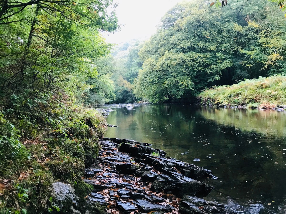
Waterside Access (England only at the moment)
All EXISTING legal waterside access. Other access may exist via permissive access.
River Mersey Existing Public Access
The Government has announced that the first of its much-trailed 9 new river walks will be the River Mersey. There is already some existing access - this map shows where this access is and where there are gaps (could be useful to reccie the missing pieces to understand what some of the barriers might be).
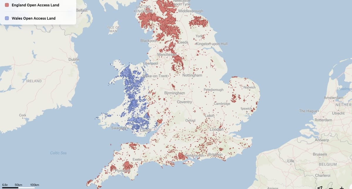
Existing open access under the Countryside and Rights of Way Act (2000). This exists across Mountain, Moor, Heath and Downland as well as Commons.
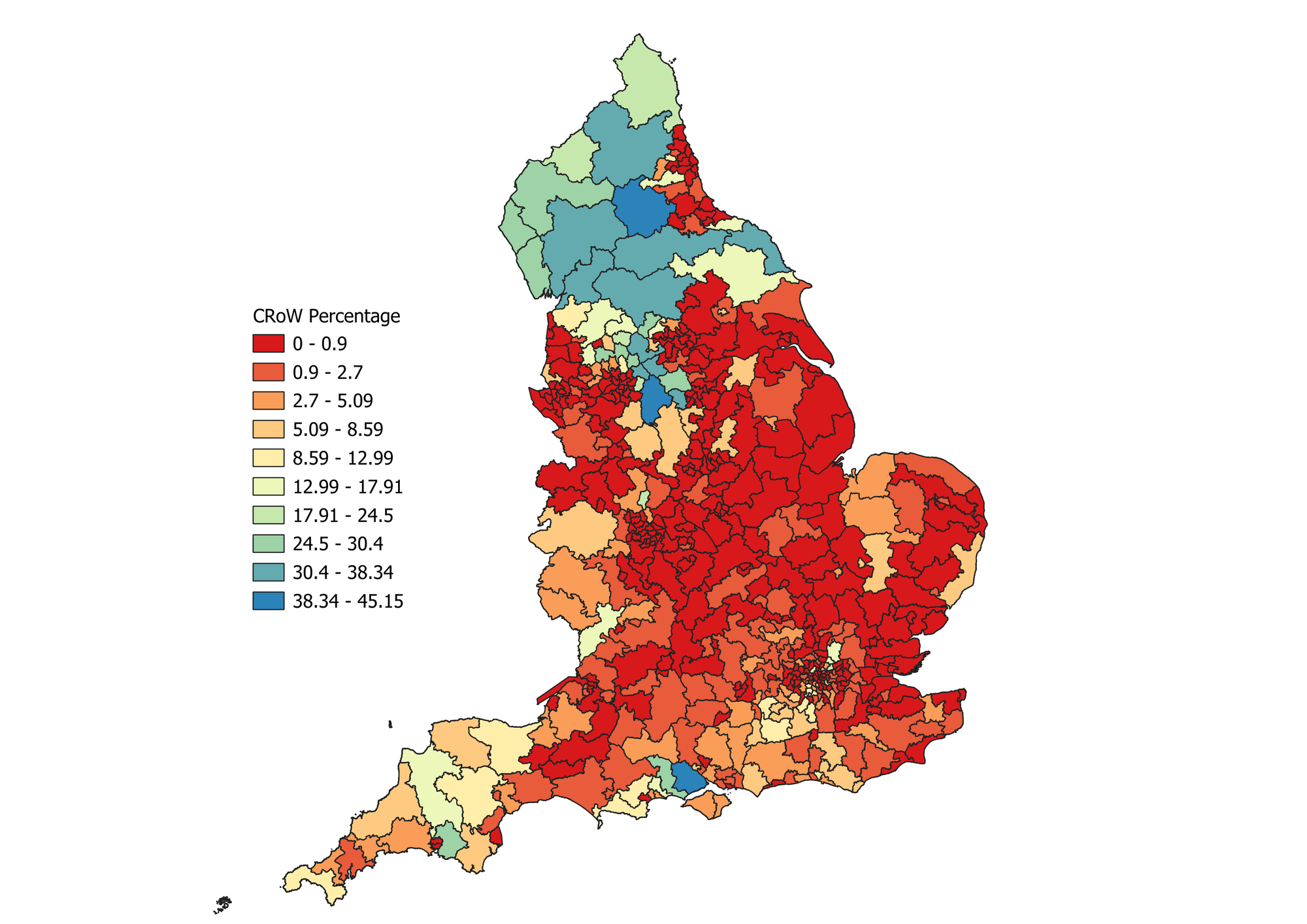
Access Deserts
Access deserts have been worked out by constituency - those with less than 20% urban extent by area, and less than 1% access land (i.e. rural with low access). See second tab in this spreadsheet for those constituencies (and mapped below).
Background on this here: